Showing posts with label Bill Sadowski Critical Wildlife Area. Show all posts

Saturday, December 18, 2010

Tracking the Great Black Hawk on Bird Count Day

The elusive Virginia Key Great Black Hawk may be spotted again today at the annual National Audubon Society Christmas Bird Count. 
The Great Black-Hawk of Virginia Key was seen and reported during the 2004-5 Virginia Key Christmas Bird Count, according to Robin Diaz, who wrote an excellent article on the life and times of this soaring bird that she describes as a “large (hawk) with short broad wings, short tail and long legs. The adult is black, while the juvenile is streaky brownish” usually seen near coastal mangroves. 
The annual bird count has been held since 1900 all around the country and is being held today in Miami Dade County with volunteers coordinated by  Tropical Audubon Society. The results provide statistics that can be used to gauge changes in the environment and the effects on bird populations. 
The statistics are also a window to the environmental deterioration that pollution, loss of habitat and climate change has wrought. 
Virginia Key is rich in bird life, from the 700-acre Bill Sadowski Critical Wildlife Area to the tropical hammock and dunes.  
In March, Tropical Audubon volunteers working with representatives of the Florida Department of Environment Protection (DEP), to document the the birds that forage, roost, nest or even merely fly over the 700-acre wildlife area that includes submerged lands, two spoil islands, intertidal mudflats and bars and tidal swamp forests along Virginia Key’s northwest shoreline. That  part of Virginia Key contains the largest remaining portion of unaltered mangrove forest and unaltered, submerged lands. 
On that trip, ospreys, great blue herons, snowy egret, ibis, cormorants, anhingas and brown pelicans were among the many species found. A look was also taken underwater to document the health of the seagrasses - including Johnson’s seagrass (Halophila johnsonii), which the federal government lists as a threatened species.


(C) 2010 copyright. All Rights Reserved. Subscribe to www.viewfromvirginiakey.com for latest articles on the ecology,history and events on Virginia Key.
Also on Facebook, join Friends of Virginia Key


Monday, December 13, 2010

Port of Virginia Key?

Map of North Point of Virginia Key under review. In the past, the land was used as a deposit site for bay bottom materials produced by channel dredging operations of the Port of Miami.  


The North Point of Virginia Key, where bicyclists want to create a mountain bike trail, and which has been closed to the public for years, was once slated to be a new airport or port facility.  
The City of Miami purchased the land from the State of Florida in 1942. The deed states that “the lands are to be used by the City of Miami for the purposes of harbors and airport constructions and development.” 

It also had this proviso: should the area be used for any purpose other than harbor or airport construction, the state would automatically get the land back. 


Of course, the City is no longer in the business of running airports or ports. In 1945, the City of Miami transferred to Miami Dade County the ownership and operation of the airport; the operation of the seaport was conveyed in 1960. 


Today the North Point is considered an environmental gem, though parts of it must still undergo significant ecological restoration.  Most of the North Point, which is next to the state-designated Bill Sadowski Critical Wildlife Area, is  zoned conservation under Miami 21, the City's new zoning code. 


(c) Copyright. All Rights Reserved ViewfromVirginiaKey.com
Also, join Facebook: Friends of Virginia Key 

Friday, November 26, 2010

Pennekamp History Offers Cautionary Tale for Virginia Key

Key Largo’s coral reefs has the John Pennekamp Coral Reef State Park. Virginia Key has the Biscayne Bay Aquatic Preserve and the Bill Sadowski Critical Wildlife Area.


Biologists monitor bird rookeries in the 700-acre Bill Sadowski Critical Wildlife Area on Virginia Key,


These special designations by the State of Florida have helped protect the wilderness areas of Virginia Key, including the surrounding waters, just as the creation of John Pennekamp State Park 50 years ago stopped the unfettered blasting and spearfishing that was on  course to devastate the fragile coral reefs off Key Largo.  
 A Miami Herald story today, “Aquatic Gem: The world’s first underwater park - John Pennekamp Coral Reef State Park” documents the tenacity of those who understood the perils the area faced and worked to save it. 
It’s a cautionary tale and an inspiration to those fighting today to protect the wilderness areas of Virginia Key from proposed development both within and adjacent to the sea turtle nesting beaches, mangroves, tropical hammock and dunes.  
Until the island becomes part of the State Park or National Park system, it’s all we’ve got. That and a band of dedicated and vigilant citizens who have managed to carry the story so far.  

@2010 Copyright. All Rights Reserved. viewfromvirginiakey.com
On Facebook: Friends of Virginia Key 

Monday, September 13, 2010

Not so fast with the bulldozers on North Point of Virginia Key


The North Point of Virginia is not the despoiled wasteland a Sept. 12 Miami Herald story ("Bike Trail Project A lot Tougher Than Expected) would have you believe.

A biological evaluation of the area by Miami Dade County’s Environmental Endangered Lands division completed earlier this year indicates the area contains acres of mangroves, tropical hammock and dune communities, all essential wildlife habitat, replete with endangered species.

Perhaps we shouldn't be so fast with those trail-blazing bulldozers after all...or so cavalier about allowing more dredge material dumping on the island from future Port of Miami projects.


In the northern and eastern portion, beach dune communities include Sea Oats, inkberry, railroad vine and burrowing four o’ clock, the latter of which is a State endangered listed species. The beach areas are essential sea turtle nesting areas.

The surrounding shallow waters along the shoreline are densely lined with seagrass beds, including turtle grass, manatee grass and shoal grass. The healthy and diverse communities support various species of sponges, invertebrates, and algae.

A high quality coastal mangrove community thrives along the west portion of North Point and is part of the state-designated Bill Sadowski Critical Wildlife Area, a 700-acre wildlife preserve created to protect the extraordinary habitat values of the area.

At the northern end of North Point is a mangrove community of red, white, and black mangroves, and green buttonwood created under supervision of the Miami-Dade County Department of Environmental Resources Management as part of a mitigation project.

The EEL report states the restoration project was performed “to resolve a violation that occurred in 1992, when Port of Miami dredging contractors damaged seagrasses, beach dunes and mangrove wetlands without authorization while Government Cut was being deepened.”

The mitigation project created five acres of coastal hammock, four acres of dune, 12 acres of new mangrove forest and new tidal habitat through the creation of new channels that run from Norris Cut to the Bill Sadowski Critical Wildlife Area.


Resources: Miami Herald, "Bike Trail Project A Lot Tougher Than Expected," Sept. 12, 2010. http://www.miamiherald.com/2010/09/12/1820390/bike-trail-project-a-lot-tougher.html

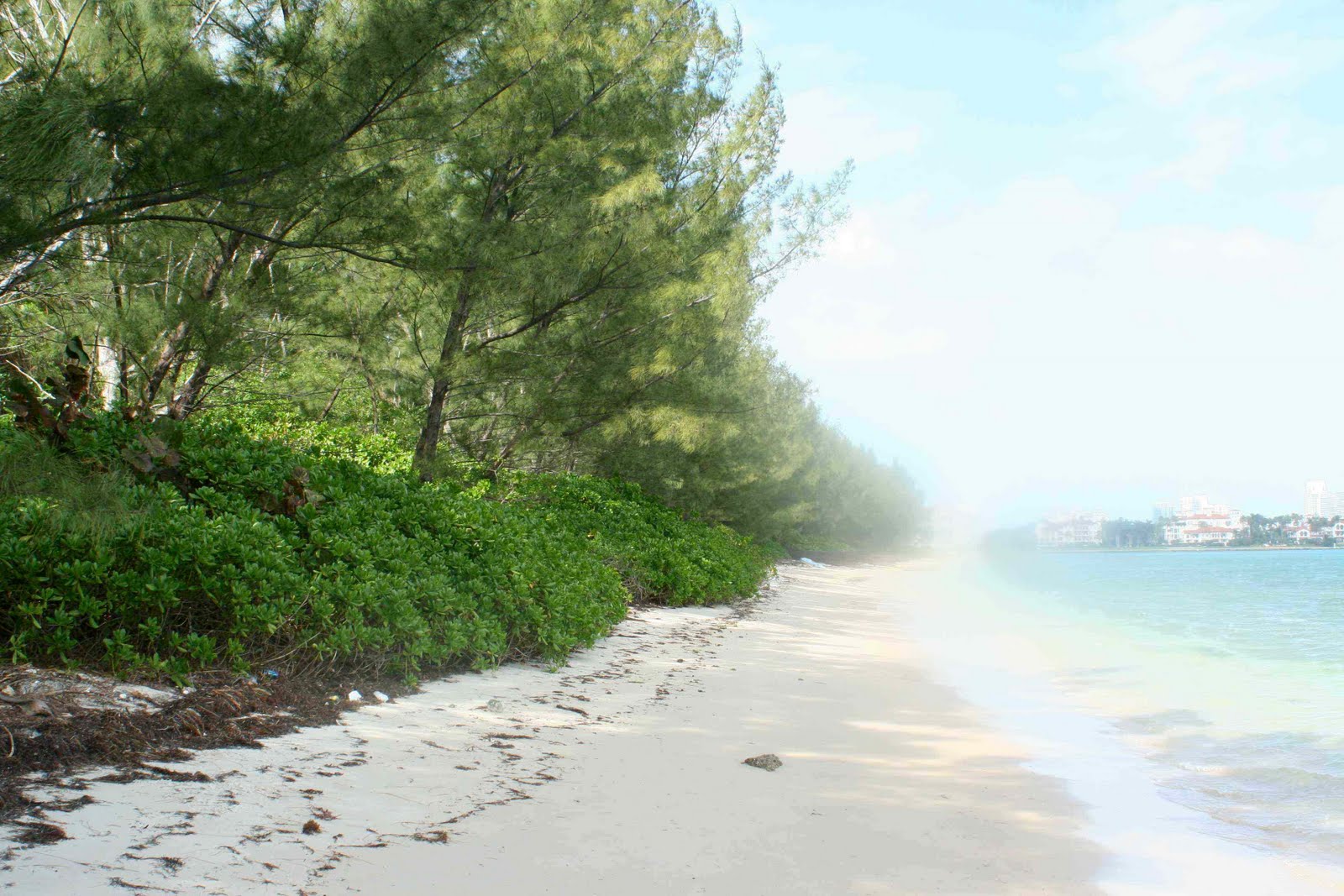
Photo: North Point beach.

Friday, July 2, 2010

Boaters Be Aware of Manatees of Virginia Key this Fourth of July weekend


Boaters traveling through and around Virginia Key this Fourth of July weekend are being asked to be especially careful of the endangered manatee, which uses the surrounding waters for feeding, resting, mating, traveling and calving.

Virginia Key is located within the Biscayne Bay Aquatic Preserve, which shares the bay with Biscayne National Park, where manatees frequent. And the Virginia Key marinas are across from the Bill Sadowski Critical Wildlife Area (CWA), a 700-acre state-designated refuge with “extraordinary habitat values” that contains the island’s largest remaining portion of unaltered mangrove forest and largest amount of unaltered, submerged land, is an important undisturbed spawning area for many species of fish and invertebrates.

The Save the Manatee Club is asking boaters to abide by posted speed limits, to slow down in shallow areas where manatees like to feed and rest and to travel through deep water channels whenever possible in the interest of saving the endangered species.

Other tips range from wearing polarized sunglasses to reduce glare and see below the water’s surface to limiting high-speed watersports (jet-skiing, water-skiing) to landlocked lakes or waters well offshore. Ideally, boaters should remain a safe distance away - at least 50 feet - while operating a boat or personal watercraft. Cut your motor if you want to observe a manatee, the club suggests.

Last year, a record 97 manatees were killed by boat strikes, according to the club. But the population also succumbed to the cold winter, with more than 500 manatees dying in the first six months of the year.

If you see an injured, dead or orphaned manatee, call the Florida Fish and Wildlife Conservation Commission at 1-888-404-3922 or #FWC or *FWC on your cellphone, or use VHF Channel 16 on your marine radio.
Resources:
http://www.savethemanatee.org/boatertips.htm
http://www.dep.state.fl.us/coastal/sites/biscayne/

Monday, June 21, 2010

Hands Across the Sand Saturday: People Power to Save Virginia Key (and Florida’s) Coastline from Gulf Oil


Florida’s marshes, wetlands and estuaries will have priority in any Gulf Oil spill prevention measures, according to Governor Charlie Crist because they are the most vulnerable and hardest to clean. That should put Virginia Key’s 700-acre Bill Sadowski Critical Wildlife Area at the forefront of local efforts.

Although you wouldn’t know it from looking at Miami-Dade County’s Environmental Resources Management Department website, which offers scant information on the County’s plans. The County does have a link for those who want to volunteer, in the event the Gulf Oil reaches our shores: http://www.iaminvolved.org/

Looks like it will be up to people to get organized. Taking photos to document current conditions is one way. Getting informed (check out the resource web sites below) is another.

So is: Holding hands across the sand in solidarity (and protest).

Saturday, June 26, you’ll get a chance to join an international movement at the Hands Across the Sand events - from “Dog Beach” on Virginia Key to in front of BP’s London headquarters - to “Help say NO to offshore drilling and Yes to clean energy.”
The Big Event in Miami Dade County - sponsored by 1 Sky, Sierra Club, Greenpeace, Surfrider Foundation, ECOMB, Environment Florida and the Urban Paradise Guild - takes place from 10:30 a.m. to 12:30 p.m., at 5th Street, (on the sand), South Beach. www.handsacrossthesanemiami.com

The Dolphin Foundation (www.savethedolphins.org) is hosting an event on Virginia Key at the “Dog Beach,” one of many thoughtout South Florida. More info: contact@thedolphinfoundation.org, (305) 305-8212.

Photo Project: Tropical Seike photo project is collecting photos of shorelines to document existing conditions. The photo-baseline project will collect images of our beaches, estauries, and harbors before and after the BP-Deepwater Horizon oil/tar arrives. Include the name of the specific site and date. The project site is: http://www.facebook.com/pages/Tropical-Selkie-gathering-the-ocean-tribes/231034041891?ref=mf

Other web sites/resources:
http://www.miamidade.gov/oem/deepwaterhorizon.asp (not too helpful right now, but they promise to keep us posted).
http://www.dep.state.fl.us/deepwaterhorizon/default.htm
http://www.thegovmonitor.com/world_news/united_states/florida-outlines-bp-gulf-oil-spill-response-for-june-20-2010-33924.html
http://www.handsacrossthesand.com/

Tuesday, March 30, 2010

Biscayne Bay's "hidden flora" is island's life force


Like a mirage on the horizon, the deep green forests of Virginia Key rise from a languid and transparent sea that is Biscayne Bay.

The life force that stirs beneath those clear, calm waters is described by Commodore Ralph Munroe in The Commodore's Story, his account of sailing and living on Biscayne Bay beginning in the late 1800's:

“No sea-lover could look unmoved on the blue rollers of the Gulf Stream and the crystal-clear waters of the Reef, of every delicate shade of blue and a green, and tinged with every color of the spectrum from the fantastically rich growths on the bottom, visible to the last detail through this incredibly translucent medium.”


Munroe undoubtedly was speaking of the seagrasses, those “rich growths” that anchor one of the most dynamic and diverse ecosystems of the 40-mile-wide bay.

Combined with the mangroves that stabilize the shoreline and provide shelter for marine life as well as birds and other animals, the lush seagrass beds found throughout Biscayne Bay and in the waters surrounding Virginia Key, form the food chain for everything for the Florida spiny lobster to shrimp, fish, sea turtles and manatees.

And for those who love to fish and/or love to eat fish, listen up: Seventy percent of Florida’s marine recreational fish depend upon seagrass communities sometime throughout their lives.

There are about 52 species of seagrasses in the world, but only seven species are found in Florida’s waters, including Johnson’s seagrass, a threatened species under federal law that is found on Virginia Key.

The shallow waters of the Biscayne Bay Aquatic Preserve that surround Virginia Key contain Johnson's seagrass, turtle grass, manatee grass and shoal grass. The area serves as an important undisturbed spawning area for many species of fish and invertebrates, including a large variety of sponges, invertebrates and algae.

Learn more: March is “Seagrass Awareness Month” and the launch of Baynanza, the annual celebration of Biscayne Bay. Hear about Seagrasses, Biscayne Bay’s “hidden flora” at a special presentation by the Biscayne Bay Aquatic Preserve staff, Wed., March 31, 6 - 7:30 p.m., at the University of Miami’s Rosentiel School (RSMAS), Seminar Room 2nd Floor, 4600 Rickenbacker Causeway, Virginia Key. Info: www.dep.state.fl.us/coastal/sites/biscayne (305) 795-3485.

Photo mural: Artist Xavier Cortada's mural, "Discover Biscayne Bay" represents the vital connection between people and the environment. It can be seen at the Miami Children's Museum. According to Citizens for a Better South Florida, which commissioned the artwork, the mural "is one component of a comprehensive education program designed to raise awareness about issues relating to Biscayne Bay like storm water run-off, deterioration of marine habitat, visual and physical access and boater safety."

Other resources:
How much do you know about Biscayne Bay? Take the quiz:
http://www.miamidade.gov/derm/quiz/bay/home.asp

Biscayne Bay Aquatic Preserve: http://www.dep.state.fl.us/coastal/sites/biscayne/

Artist Xavier Cortada: http://www.cortada.com/
Citizens for a Better South Florida: http://www.abettersouthflorida.org/

2010 Copywright @ All Rights Reserved
Also on Facebook: join Friends of Virginia Key

Tuesday, March 9, 2010

Kayakers Conduct Bird Survey of Virginia Key


The orange and yellow kayaks were lined up neatly along the shoreline of the Marine Stadium basin, the turquoise waters of the lagoon lapping up against them under a cloudless blue sky. With gear in hand - cameras in dry bags, binoculars and clipboards holding the survey lists- about a dozen volunteers had gathered to begin the first of several wildlife expeditions into the Bill Sadowski Critical Wildife Area (BSCWA) of Virginia Key.

“There’s a bird walking along the shoreline. Does that count?” someone asked, pointing to a cormorant surveying the group.

“Nope,” said Laura Reynolds, executive director of the Tropical Audubon Society and coordinator of the trip. “It has to be in the Critical Wildlife Area, and after we get in the kayaks.”

Audubon volunteers joined Florida Department of Environmental Protection (DEP) biologists on a recent Saturday in the first of many wildlife surveys planned to document the birds that forage, roost, nest or even merely fly over the 700-acre area that includes submerged lands, two spoil islands, intertidal mudflats and bars and tidal swamp forests along Virginia Key’s northwest shoreline. This part of Virginia Key contains the largest remaining portion of unaltered mangrove forest and unaltered, submerged lands.

The Sadowski Critical Wildlife Area received its state designation, one of the few in the state, to protect the extraordinary habitat values of the area. As such, it carries with it a prohibition against entry by people and vessels. The kayakers entered the area only with a special permit from the Florida DEP.

Since its designation in 1990 there has been little data collected - either on the inhabiting birds, submerged underwater vegetation or manatees.

This trip will help remedy that.

The kayaking volunteers paddled across the basin and alongside the shoreline of the CWA, parallel to the mangrove fringes, weaving through the vegetation islands, observing and recording their observations.

Ospreys, great blue herons, snowy egret, ibis, cormorants, anhingas and brown pelicans were among the many species found. A look was also taken underwater to document the health of the seagrasses - including Johnson’s seagrass (Halophila johnsonii), which the federal government lists as a threatened species.

“We need to accurately document abundance, diversity and function of birds using the area,” said Jennifer Baez, an environmental specialist with DEP’s Coastal and Aquatic Managed Areas division, who brought along a special underwater camera and GPS. “The information collected through these surveys will show why this area is critical for many marine organisms.”